Grd
Advertisement
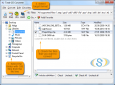
Total GIS Converter v.1.5
Total GIS Converter is a powerful converter of GIS files. It converts AEP, GRD, ADF, E00, FLT, APR, SHP, DXF and many other GIS formats to TIFF, PNG, JPEG, BMP. Along with conversion it can scale and resize your files. Download your free copy now!
Preset Viewer v.2 1
Preset viewer breeze lets you view: brushes (abr), patterns (pat), custom shapes (csh), styles (asl), gradients (grd), contours (shc), documents (psd), swatches (aco, ase, act, acb, ado) and more files types.
Advertisement
Oasis montaj Viewer v.7 3
Oasis montaj Viewer is a easy-to-use program that allows anyone to view, share, and print published Geosoft grid (.grd) and database (.gdb) files.
Geosoft Plug-In for ER Viewer v.7.0
Geosoft Plug-In for ER Viewer enables users to view and use Geosoft grid (.grd) and map (.map) files in the ER Viewer application. This plug-in use a globe explorer, to find, view, and extract data from a variety of data servers.
Krueger K-Select v.10.0.0.27
K-Select provides you with a terminal and GRD selection program that incorporates powerful engineering tools to provide a design reference that can save significant time in the design of a building's HVAC system.
Bivius v.3.0
The BIVIUS application is an easy-to-use tool for analyzing the pressure/depth data generated by pressure test equipment at the well site.
Geoblock v.2010.1.5 Build 124
An easy-to-use software for 3D modeling. The Geoblock software is integrated program for 2D/3D modeling, computational geometry and visualization of spatial datasets. The software can be used in Earth sciences particularly in such fields as survey,
Global Mapper v.12.00
Create Better Maps with Global Mapper. Think of it as a word processor for geographic data. With a digital representation of your data, you can create printed maps or digital map files that can be downloaded into Garmin GPSr's.
Geosoft Desktop Cataloger v.7.5.1
The Geosoft Desktop Cataloger is a free utility that helps you build a catalog of your spatial files from your local drives, and lets you easily find that data when using Geosoft exploration software (Oasis montaj, Target) or Geosoft exploration soft